News Summary
Severe thunderstorm warnings have been issued across South Carolina, particularly affecting Fairfield, Lexington, Newberry, Richland, and Saluda counties. The storms are expected to bring high winds, possible tornadoes, and significant rainfall through the weekend. Residents are advised to seek shelter and stay informed as conditions evolve. Keep an eye on power outages that could affect thousands in the area.
Severe Thunderstorm Warnings Hit South Carolina
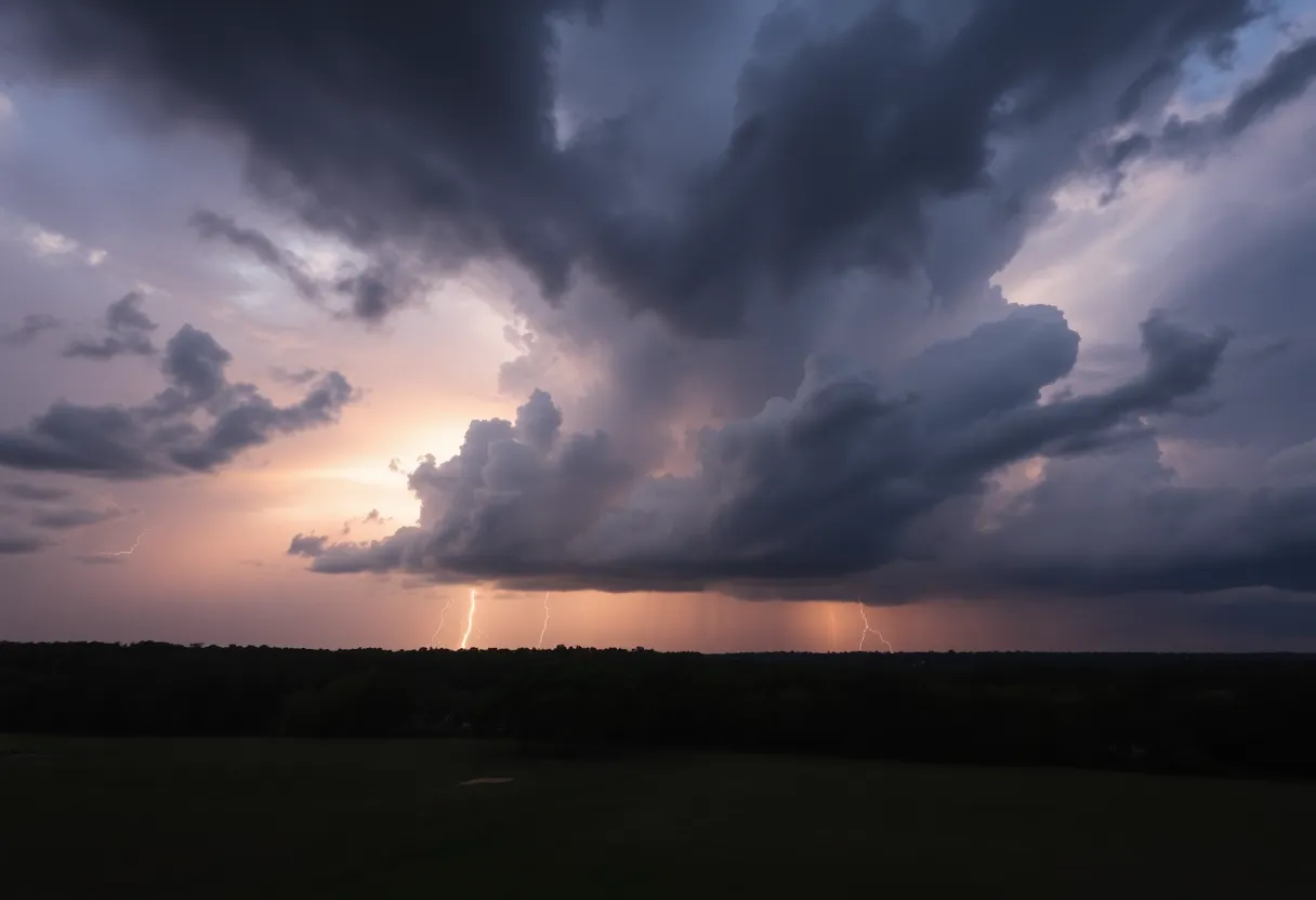
It’s a stormy night across South Carolina, especially looming over the lovely areas of Fairfield, Lexington, Newberry, Richland, and Saluda counties. The National Weather Service (NWS) in Columbia has issued a severe thunderstorm warning that’s active until 8:30 p.m. tonight. So folks, it’s time to tuck in and batten down the hatches!
What To Expect Tonight
As of 8:07 p.m., those storms were stretching from near Blair to near Prosperity and even brushing 11 miles northeast of Saluda. These unruly clouds are moving southeast at a speed of approximately 15 mph. So, if you’re in these areas, you’ll want to be prepared for some wild weather!
Keep your eyes peeled for howling winds that could gust up to a surprising 60 mph. That’s strong enough to knock over trees and take down power lines, so stay vigilant. Areas that will likely feel the storm’s wrath include popular spots like the VC Summer Nuclear Station, Mid-Carolina High School, and the regions along Interstate 26 between mile markers 78 and 95.
Playing It Safe
As these storms roll in, safety should be your priority. The NWS recommends that everyone keep it safe by heading to an interior room on the lowest floor of your home. It’s always better to be safe than sorry when these frightening storms come knocking!
Now, let’s not forget about lightning! Did you know it strikes the USA about 25 million times each year? With summer storms usually being the main culprits, these lightning strikes can lead to around 20 fatalities annually. So, when the thunder starts rumbling, you can expect the likelihood of lightning to ramp up, peaking when the storm is right over your head.
Storm Concerns Over the Coming Days
Today’s not the only night for severe weather, as the area might see continued storms through the weekend, extending all the way into Monday. Stay on your toes, because there’s a good chance of additional thunderstorms, and even the dreaded tornadoes may make an appearance! The time frame for the most severe weather is primarily between 10 a.m. and 4 p.m. on Sunday.
In fact, storms could leave up to an inch of rain accumulation in some areas by the time the weather clears out late Monday night. So if you’re near Lake Murray, it’s advisable to find safe shelter as these storms make their way through.
Storm Aftermath
Many residents had a rough night before, with over 10,000 customers losing power thanks to storms that blasted through earlier. And with winds possibly exceeding 60 mph tonight, it appears more outages might be on the horizon. The severe weather is not just an inconvenience; it comes with serious threats like damaging winds, large hail, and the not-so-great possibility of tornadoes.
Stay Tuned!
As the NWS keeps a watchful eye on evolving conditions, they may issue further warnings as necessary. So stick around and keep your radios and phones handy. It’s not just about surviving the storm tonight, but also staying informed for whatever else is coming our way this weekend. Stay safe, South Carolina!
Deeper Dive: News & Info About This Topic
HERE Resources
Chapin, South Carolina Suffers EF-1 Tornado Damage
Family Advocates for Lake Safety After Tragic Loss
Extreme Heat Wave Hits the Northeastern U.S.
Severe Thunderstorms Lead to Widespread Power Outages in Lowcountry
Severe Weather Impacts Millions Across the U.S. This Weekend
Severe Flash Flooding Devastates Texas Hill Country
Wrapabull: Personalizing the Art of Custom Wrapping
Devastating Tornado Outbreak in North Dakota Claims Three Lives
Severe Thunderstorm Warnings Issued for South Carolina
Tornado Hits Chapin, South Carolina
Additional Resources
- Island Packet: Severe Weather Update
- Wikipedia: Severe Thunderstorm Warning
- The State: Weather Report
- Google Search: Severe Weather South Carolina
- WLTX: Weather Impact Alert
- Encyclopedia Britannica: Thunderstorm
- WACH: Midlands Weather Blog
- Google News: Thunderstorms South Carolina