News Summary
Strong thunderstorms are expected in Midlands South Carolina, with the National Weather Service issuing warnings for Newberry and Fairfield counties. Residents are advised to seek shelter due to potential wind gusts of up to 50 mph and hail. Motorists should be cautious of hydroplaning as the storms approach. Additional alerts extend across several areas, with heightened risks for tornadoes and power outages. Community members are urged to stay informed and take necessary precautions regarding the severe weather conditions.
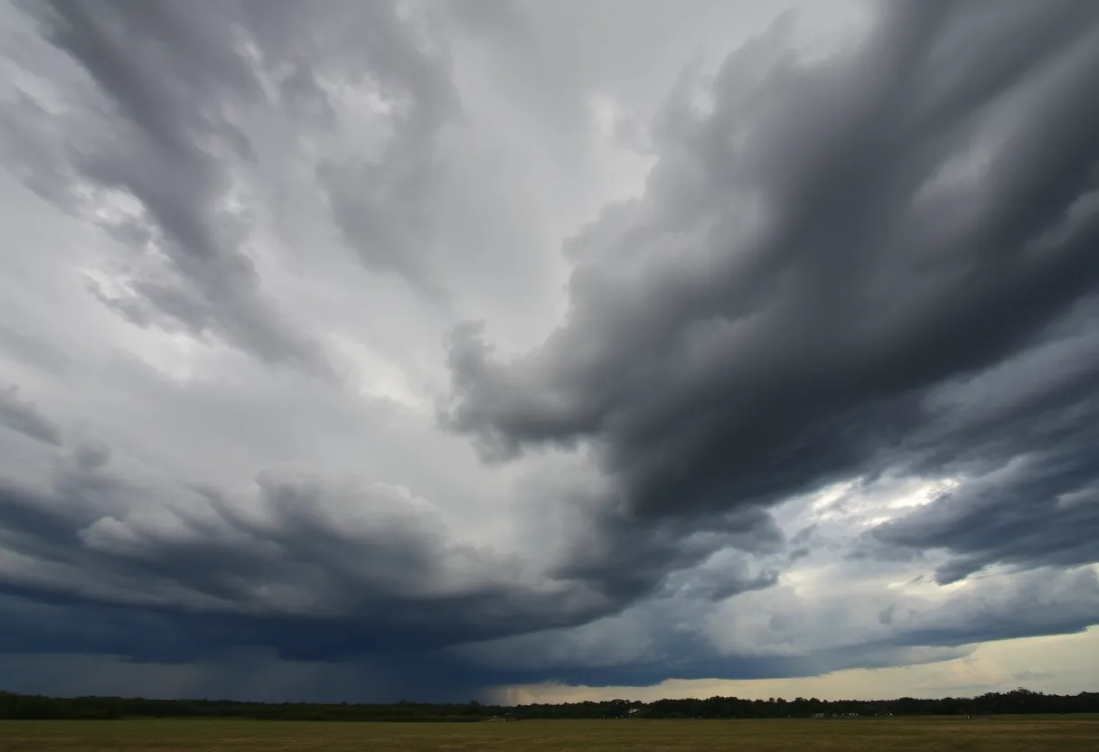
Midlands South Carolina Faces Severe Thunderstorm Risks
Columbia, SC – Strong thunderstorms are anticipated in Midlands South Carolina, prompting the National Weather Service (NWS) Columbia SC to issue a severe thunderstorm warning for Newberry and Fairfield counties until 6 p.m. on Friday. The storms may generate wind gusts of up to 50 mph, along with the possibility of marble-sized hail measuring approximately 0.5 inches.
At 5:12 p.m., Doppler radar identified a thunderstorm near Blair, traveling northeast at a speed of 25 mph. Areas likely to be affected include Blair, Henderson Island, Maybington Fire Station, US-176, SC-34 Crossroads, and Feasterville Fire Station, as well as a stretch of Interstate 26 between mile markers 71 and 75.
Residents are urged to seek indoor shelter during these thunderstorms, as gusty winds may cause tree limbs to fall and displace unsecured objects, resulting in minor damage to outdoor items. The warning remains valid until 6 p.m., and those near the impacted areas are encouraged to act swiftly to ensure their safety.
Lightning and Travel Hazards
The NWS reports that in the United States, approximately 25 million lightning strikes occur each year, resulting in roughly 20 fatalities annually. As thunderstorms approach, the incidence of lightning strikes intensifies, peaking when a storm passes overhead. To mitigate risks associated with thunderstorms, individuals should prioritize finding shelter indoors.
Motorists should also be cautious of hydroplaning, a dangerous phenomenon where vehicles slide uncontrollably on wet surfaces. This condition arises when water accumulates in front of tires, hindering their contact with the roadway. Common causes of hydroplaning include excessive speed, worn tires, and standing water.
Additional Alerts for the Region
During this time, dime-sized hail was reported near Chapin, and officials anticipate that damaging winds will persist throughout the day. Moreover, the potential for tornado warnings exists in various parts of the eastern Midlands and Pee Dee region.
Risk Areas and Safety Measures
Residents in regions with heightened risks, such as Lee, Sumter, eastern Calhoun, Clarendon, and eastern Orangeburg counties, should stay vigilant. A marginal risk for severe weather is reported in areas including Newberry, Saluda, and parts of Fairfield County, while a slight risk extends from the central Midlands to the Lowcountry. The most intense storms are projected in the eastern Midlands, Grand Strand, and far eastern North Carolina, where an enhanced risk of severe weather is anticipated.
In light of these developments, residents are recommended to take preventive measures by charging essential devices due to the possibility of power outages, securing outdoor belongings, and avoiding outdoor burning, as fire risks are elevated. The South Carolina Forestry Commission has issued a statewide burn ban due to the increased likelihood of rapidly spreading fires.
Community members are urged to remain informed about weather conditions and follow safety recommendations during this severe weather situation to protect themselves and their property.
Deeper Dive: News & Info About This Topic
HERE Resources
Severe Thunderstorm Warning Issued for Newberry and Fairfield Counties
Severe Thunderstorm Alerts Hit South Carolina: Stay Prepared!
Midlands Celebrates Easter Weekend with Activities
Severe Weather Alert: Strong Storms Expected in Columbia, SC
Severe Weather and Heavy Rain Expected in Columbia
Record High Temperatures and Rain Forecast for Columbia, S.C.
Severe Weather Hits Columbia: Tornado and Thunderstorm Warnings
Midlands Faces Severe Weather Peak with Tornado Threats
Lexington’s Dining on the Dam Event Canceled
Columbia Prepares for Severe Thunderstorm Alert
Additional Resources
- Island Packet
- Wikipedia: Thunderstorm
- The State
- Google Search: severe thunderstorm safety
- ABC Columbia
- Encyclopedia Britannica: Weather
- WLTX
- Google News: severe weather March 2025