News Summary
In South Carolina, severe thunderstorms are expected, prompting alerts from the National Weather Service. Areas like Newberry and Lexington counties face wind gusts up to 50 mph and hail. Residents in impacted counties are urged to stay alert as more storms are expected through the weekend, potentially leading to hazardous conditions including lightning and hydroplaning risks. While storms may bring severe impacts, warmer weather is predicted after the storms pass.
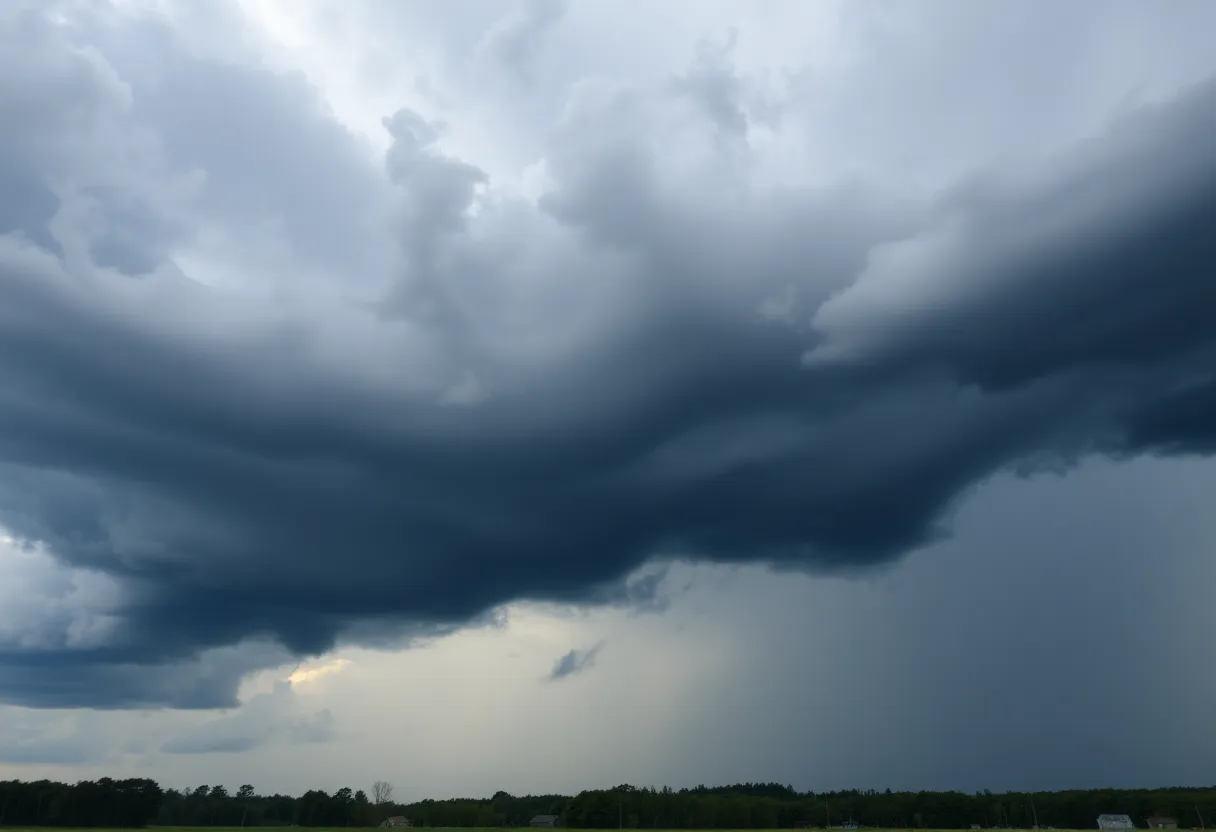
Severe Thunderstorm Alerts Hit South Carolina: Stay Prepared!
Hey there, folks! If you’re in South Carolina, it’s time to pay attention because some severe thunderstorms are rolling our way. The National Weather Service in Columbia has just issued some important weather alerts that everyone should take seriously.
Initial Alerts: Newberry and Lexington Counties
It all began on Wednesday night, shortly before 9 PM. The advisory for areas like Newberry and Lexington counties warned locals to be on high alert until around 9:45 PM. Thunderstorms in the area were packing a punch with wind gusts soaring up to 50 mph and hail the size of a penny—about 0.75 inches in diameter. That’s no joke!
Earlier reports showed a powerful storm making its way near Dreher Island State Park, moving slowly to the northwest at about 5 mph. Residents from towns like Chapin, Melvin Park, and Little Mountain were urged to take precaution, especially with reports of dime-sized hail popping up near Chapin. If you were outside during that time, your best bet was to find some shelter! And don’t forget, this includes the busy Interstate 26 near mile marker 88.
Second Update: Richland and Surrounding Counties
Fast forward to Thursday afternoon, and the weather had people buzzing again. Another update dropped at about 4:25 PM, expanding alerts to Richland, Sumter, Calhoun, and Clarendon counties, valid until around 5:15 PM. Forecasts showed the potential for similar wind gusts up to 50 mph and marble-sized hail—yes, that’s around 0.5 inches! This storm was on the move, tracking from near Poinsett State Park to about six miles northwest of Elloree, cruising east at roughly 20 mph.
So, if you’re located in areas like Poinsett State Park, Pinewood, Creston, or Lakewood, it was time to take this seriously. Storms were affecting quite a few places, and local residents were encouraged to keep an eye on reliable channels for weather updates.
Lightning and Hydroplaning Risks
And let’s talk about lightning. Did you know that in the U.S., lightning strikes about 25 million times a year? Most happen in summer, and sadly, around 20 people lose their lives annually due to this force of nature. The risk skyrockets as thunderstorms roll in, especially when they are right on top of you. When thunderstorms occur, it’s best to stay tucked away indoors.
Also on the radar is the risk of hydroplaning. That’s the slippery situation when your vehicle slides uncontrollably on wet roads. While the main reasons for this weren’t detailed, it’s important to remember that wet conditions can lead to dangerous driving. So, if you’re out and about, remember to drive safely!
What’s Next? Anticipating More Bad Weather
As we look ahead, the forecast isn’t light. Get ready for rain and thunderstorms on Sunday, and a major weather event expected on Monday could bring severe conditions, including the threat of tornadoes. Heavy downpours are predicted Sunday afternoon, with the worst of it hitting between 2 PM and 7 PM on Monday.
Currently, a Severe Thunderstorm Watch is active until 9 PM for places like Calhoun, Clarendon, Kershaw, Lee, Orangeburg, and Sumter Counties, mainly due to the threat of damaging winds. A few spotty showers may linger into the night before it finally clears up.
Looking Ahead: Warm Weather After the Storm?
Once the storms pass, enjoy the warmer temperatures expected later in the week, with highs potentially approaching 90°F on Friday and Saturday. So while we’re in for a rough patch of weather, it seems sunshine and warmth are on the horizon!
Stay safe, South Carolina! Keep those weather alerts handy, and let’s hope for the best!
Deeper Dive: News & Info About This Topic
HERE Resources
Carolina Wildfires Prompt State of Emergency and Evacuations
Myrtle Beach Faces Wildfire Crisis Amid State of Emergency
Midlands Celebrates Easter Weekend with Activities
Upcoming Road Closures in Lexington County
Duke Energy Foundation Allocates $500,000 in Grants for SC
Irmo Proposes New Ordinance to Address Parking Issues
Snow Flurries Hit Upstate South Carolina Amid Warnings
Sunny Skies and Events to Enjoy This Week
Wildfires Rock North and South Carolina
Chapin Prepares for the Fifth Annual Car Show
Additional Resources
- The State
- MSN Weather
- WLTX
- ABC Columbia
- WACH Weather Blog
- Wikipedia: Thunderstorm
- Google Search: Severe Weather Alerts South Carolina
- Google Scholar: Thunderstorm Safety
- Encyclopedia Britannica: Thunderstorm
- Google News: Severe Thunderstorms