News Summary
Columbia residents should brace for severe thunderstorms and possible tornadoes this weekend. The National Weather Service has issued tornado watches and warnings as conditions escalate. With rain expected and wind gusts approaching 60 mph, locals are urged to stay informed about the rapidly changing weather. Despite these challenges, events such as the 6th annual Live on Lincoln and Artista Vista festivities will still take place. Read on for a detailed forecast and safety updates.
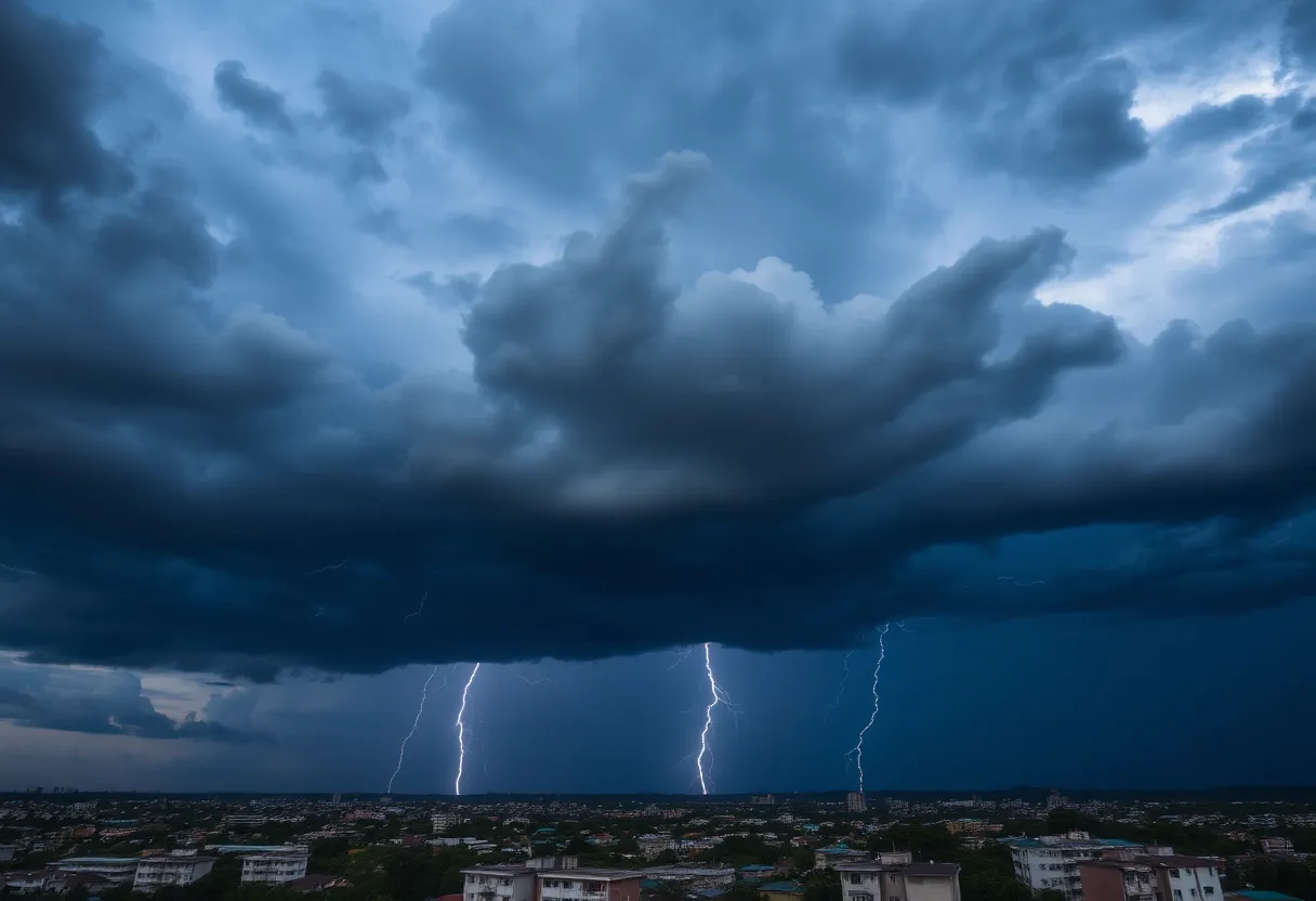
Severe Thunderstorms and Tornadoes Loom Over Columbia This Weekend!
Hey there, Columbia! It looks like you’re going to want to keep your eyes on the sky this weekend. Cloudy weather is setting in bright and early on Sunday, giving us a little taste of what’s to come. But don’t let the calm fool you—strong thunderstorms are gearing up to roll in later in the day. Make sure you’ve got your rain gear ready!
Weather Forecast for Sunday
As we slide into Sunday, the weather is going to warm up a bit, with temperatures hitting a cozy 77°F. But hold on, because those warm vibes come with a catch! Winds are expected to kick up from the south-west at speeds of 10 to 15 mph, which can stir things up quite a bit. With about a 70% chance of rain, you’ll want to keep your umbrella handy—just in case!
The weather is expected to shift to partly to mostly cloudy conditions with scattered thunderstorms before midnight. Keep in mind, the temperature will cool off a bit to a low of around 56°F, and winds will change direction, shifting to the west at similar speeds.
Severe Weather Alerts
Heads up, folks! Authorities have already issued tornado warnings for the Columbia area early Sunday morning. The morning hours saw severe thunderstorm warnings in effect until around 8:30 AM, and a tornado watch is still active until 2 PM, covering multiple counties, including Richland and Lexington. Keep an ear out for any updates—conditions are set to escalate!
Residents can expect significant wind gusts approaching 60 mph in the Columbia area, and heavy rainfall might cause localized flash flooding. If you’re planning to be near any area lakes, be aware: a lake wind advisory is currently in place, indicating hazardous conditions for small craft. Rainfall could amount to as much as half an inch, making your Sunday plans a little soggier than planned!
The Week Ahead
Looking ahead, as we flip the calendar to Monday, a cold front is on the way, which means more severe thunderstorms could be brewing. Expect the most intense weather between 2 PM and 7 PM, with conditions being monitored closely. So, make sure you have a reliable way to receive those important weather alerts!
After the stormy weather clears out, it seems we’ll be diving back into warmer temperatures again. Highs will hover around 80°F as we move through the week. A little bit of sunshine never hurt anyone, right?
Weekend Events Come Rain or Shine
Also happening this weekend are the Artista Vista events from April 11 to April 13, featuring a gallery crawl, an Art Day, a Live Art Mart, and even a light and lantern parade. So, whether you’re weathering out a storm or enjoying the art scene, there’s plenty happening in Columbia!
Deeper Dive: News & Info About This Topic
HERE Resources
Severe Weather Set to Strike Columbia, South Carolina on Monday
Severe Weather Warnings Issued for Columbia and Lexington Counties
Severe Weather Looming Over Columbia, SC
Irmo High School’s Expansion Project Underway
New East Wing Construction at Irmo High School
Winter Storm Approaches Columbia: Prepare for Snow and Cold
Columbia Residents Warned Against Unauthorized Payment Platform
Severe Thunderstorm and Tornado Warnings Hit Columbia, SC
Spring Allergy Alert: Columbia and Greenville in the Pollen Hot Seat
Fire Danger Alert in the Carolinas: Stay Safe!
Additional Resources
- WLTX: Severe Thunderstorm Threat in South Carolina
- Oregon Live: Thunderstorms with Hail in Oregon
- The State: Weather News Update
- TDN: Local Weather Update
- WLTX: Weekend Storm Update
- Wikipedia: Severe Thunderstorm
- Google Search: Severe Weather Alerts
- Google Scholar: Thunderstorm Predictions
- Encyclopedia Britannica: Thunderstorm
- Google News: Severe Thunderstorms